Farm Designer
Drag-and-drop plant placement ![]() Open this page in the app
Open this page in the app
The farm designer allows you to graphically design the layout of your garden, monitor your FarmBot’s position, and visualize data such as photos, plant spread, and points.
Map menu
Click the white button in the top right of the map to open up the map menu. Here you will find and buttons to zoom in and out of the map, as well as toggles to turn on and off map layers. Some map layers have submenus with additional options.
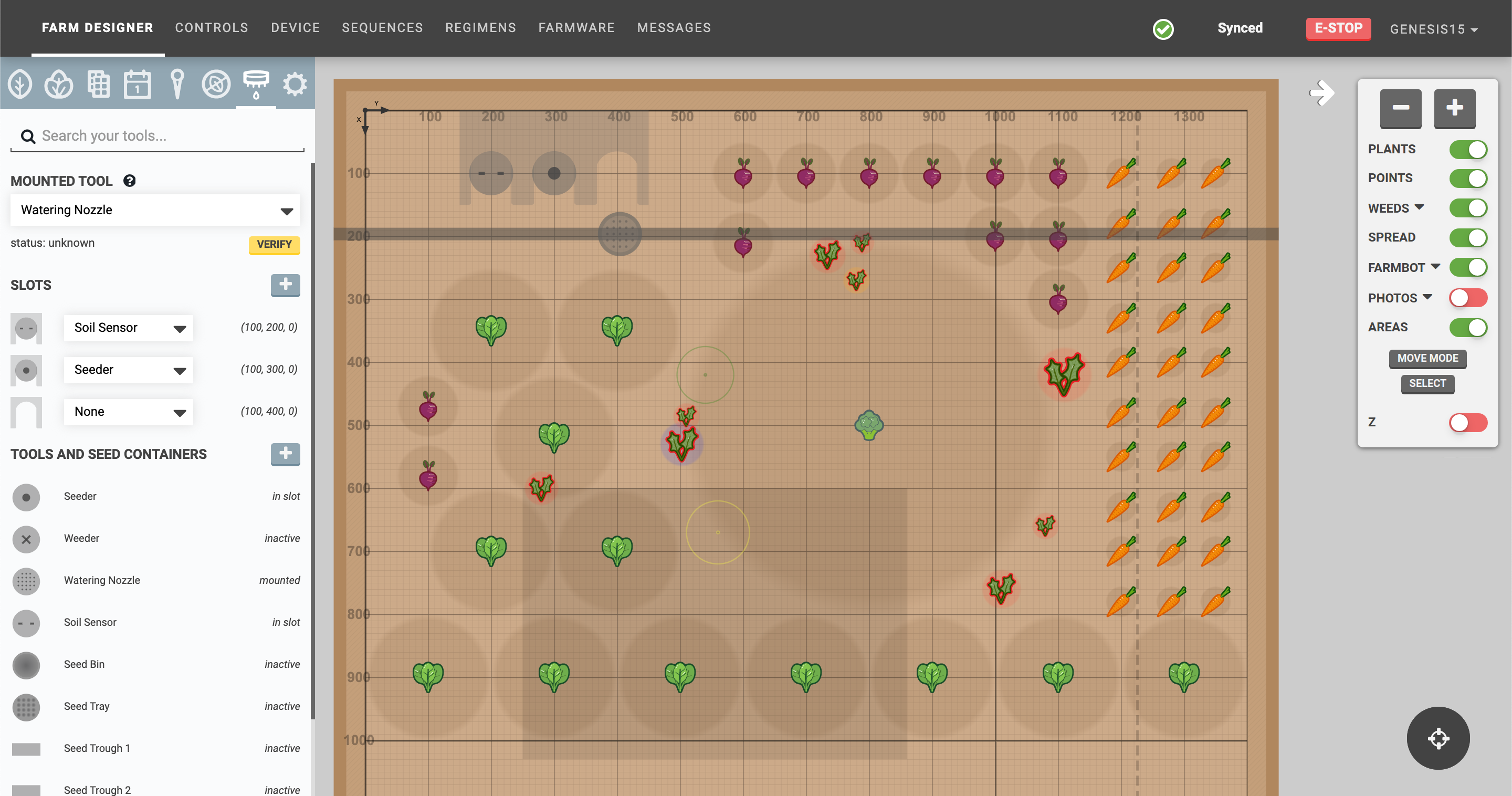
Plants
The PLANTS toggle displays or hides plant icons and their current size shadow. Within the plants submenu:
- PLANT ANIMATIONS enables or disables plant animations in the garden map. This may be useful to turn off when using the app on a lower powered device such as a smartphone or chromebook, or if experiencing performance issues.
- CONFIRM PLANT DELETION shows a confirmation dialog when deleting a plant.
Points
The POINTS toggle displays or hides all points created from the points panel.
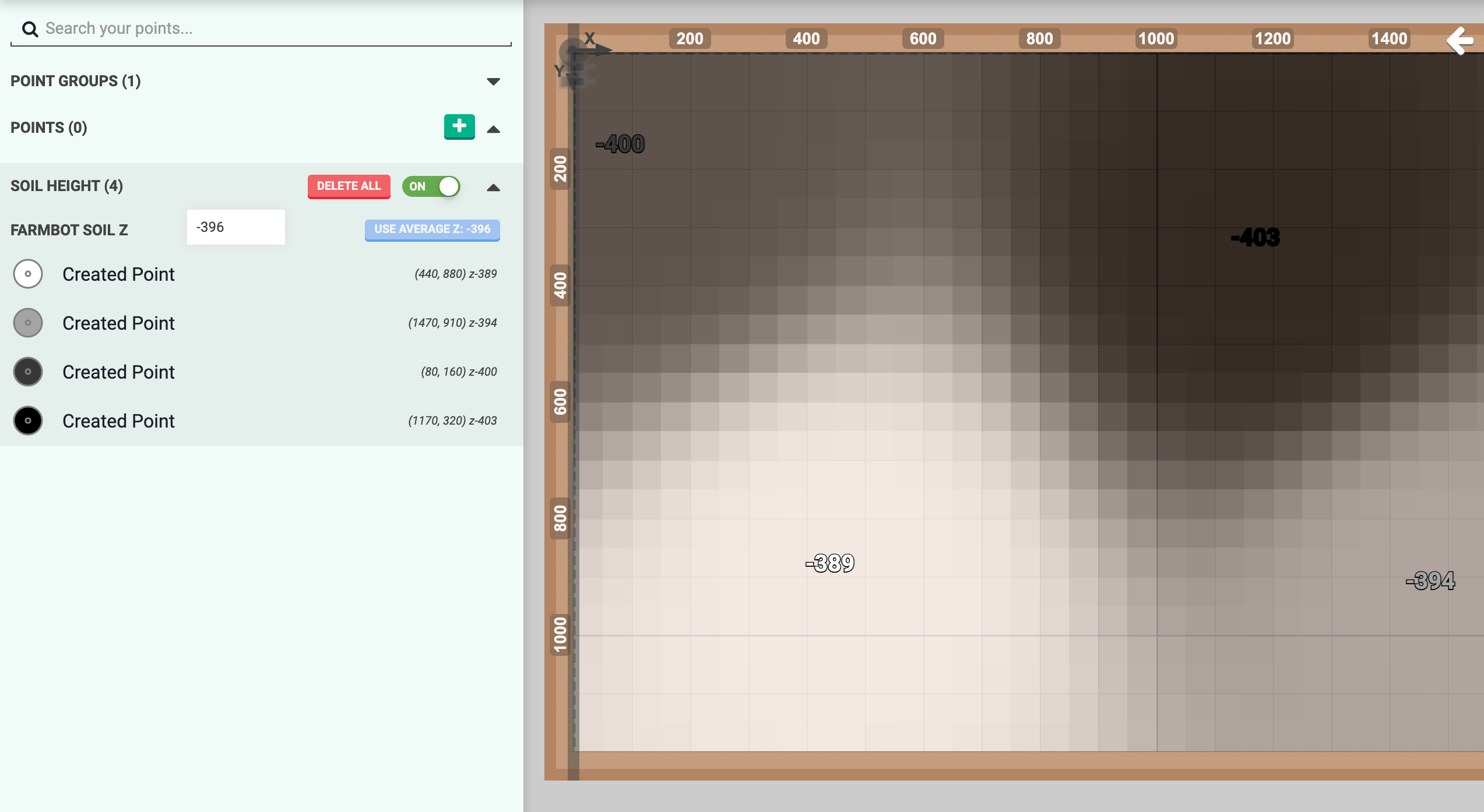
Soil
The SOIL toggle displays an interpolated map of soil levels based on soil height measurements.
Weeds
The WEEDS toggle displays weed icons and their current size shadow. Within the weeds submenu:
-
SHOW REMOVED displays weeds with a status of
Removed.
Spread
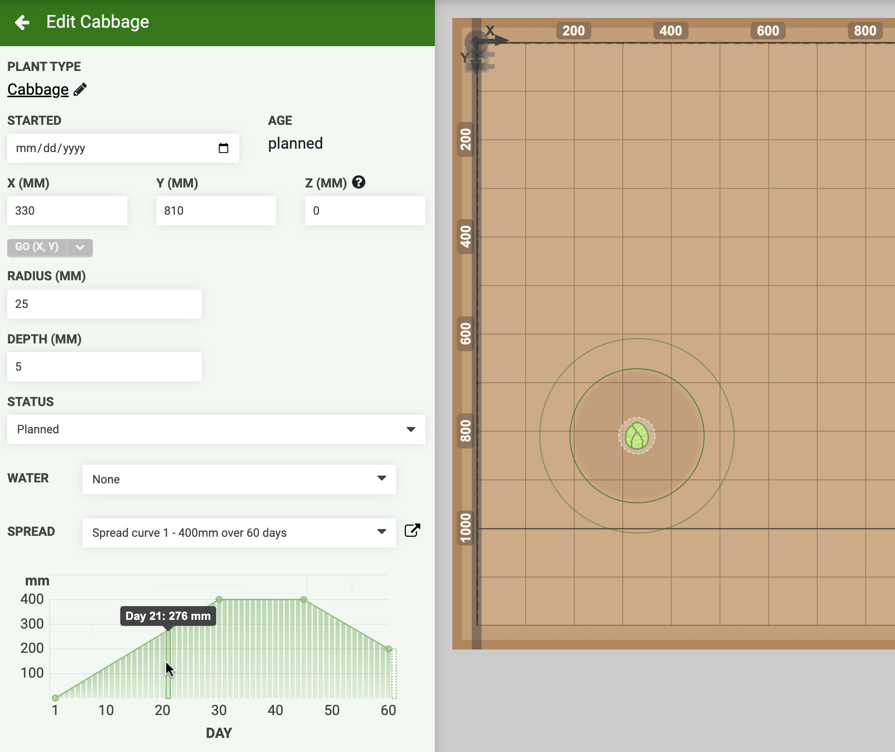
The SPREAD toggle displays the spread of plants as a ring around the plant. This ring represents the space that the plant will occupy once fully grown. Plants with a spread value provided by OpenFarm will have a green spread ring. If a spread value from OpenFarm was not available when the plant was created, the spread ring will be white and have a fallback diameter of 250mm.
Once a plant is created in the app, the spread value will not be updated if the plant’s spread value changes in OpenFarm.
If a plant has an assigned spread curve, then the expected spread of the plant at a certain age can be visualized by hovering over the spread curve.
FarmBot
The FARMBOT toggle displays the FarmBot gantry, UTM or tool head, slots, tools, seed containers, peripheral state visualizations, and axis limit lines. Within the FarmBot submenu:
- TRAIL displays a virtual trail for FarmBot in the garden map to show movement and watering history while the map is open. Toggling this setting will clear data for the current trail.
- FARMBOT MOTOR LOAD displays high motor load warning indicators in the map. Requires TRAIL and STALL DETECTION to be enabled.
Photos
The PHOTOS toggle displays photos taken by FarmBot’s onboard camera. Within the photos submenu:
- NEWER THAN/OLDER THAN filters the display of photos by date and time.
- CROP MAP IMAGES crops images displayed in the garden map to align rotation-corrected image edges with the coordinate system. Crop amount determined by CAMERA ROTATION value.
- CLIP PHOTOS OUT OF BOUNDS removes portions of images that extend beyond the garden map boundaries.
- CAMERA VIEW displays the camera’s field of view in the garden map. This is useful when manually positioning the FarmBot’s camera directly over an object for photographing.
- UNCROPPED CAMERA VIEW displays the camera’s uncropped and unrotated field of view in the garden map when CROP MAP IMAGES is enabled.
See camera calibration if photos are not positioned, scaled, or rotated correctly.
Areas
The AREAS toggle displays areas defined by group filters.
Readings
The READINGS toggle displays sensor readings.
Moisture
The MOISTURE toggle displays an interpolated map of soil moisture based on recent soil moisture readings.
Z
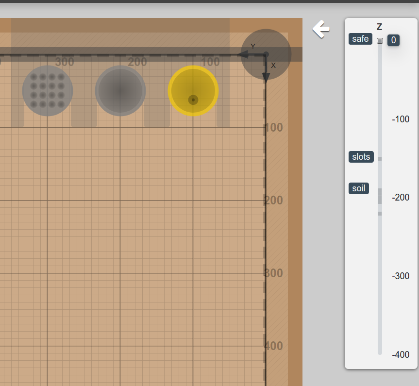
The Z toggle shows FarmBot’s current z-axis position and relevant garden levels in a graphical display next to the map menu.
Map settings
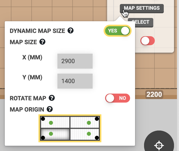
Dynamic map size
Set the garden map size based on the AXIS LENGTH values. A value must be input in AXIS LENGTH and STOP AT MAX must be enabled.
When enabled, DYNAMIC MAP SIZE will override MAP SIZE values.
DYNAMIC MAP SIZE only affects the display of the virtual garden map in the app. This setting will not affect the area in which FarmBot is allowed to move in. To change where FarmBot is allowed to move, see the settings available in the Axes section.
Map size
Specify custom map dimensions (in millimeters). These values set the size of the virtual garden map unless DYNAMIC MAP SIZE is enabled.
MAP SIZE only affects the display of the virtual garden map in the app. This setting will not affect the area in which FarmBot is allowed to move in. To change where FarmBot is allowed to move, see the settings available in the Axes section.
Rotate map
Swap map X and Y axes, making the Y axis horizontal and X axis vertical. This setting will also swap the X and Y jog control buttons .
ROTATE MAP only affects the display of the virtual garden map in the app. This setting will not affect the coordinate system of the FarmBot.
Map origin
Select a map origin by clicking on one of the four quadrants to adjust the virtual garden map to your viewing angle.
MAP ORIGIN only affects the display of the virtual garden map in the app. This setting will not affect the coordinate system of the FarmBot.
Move mode
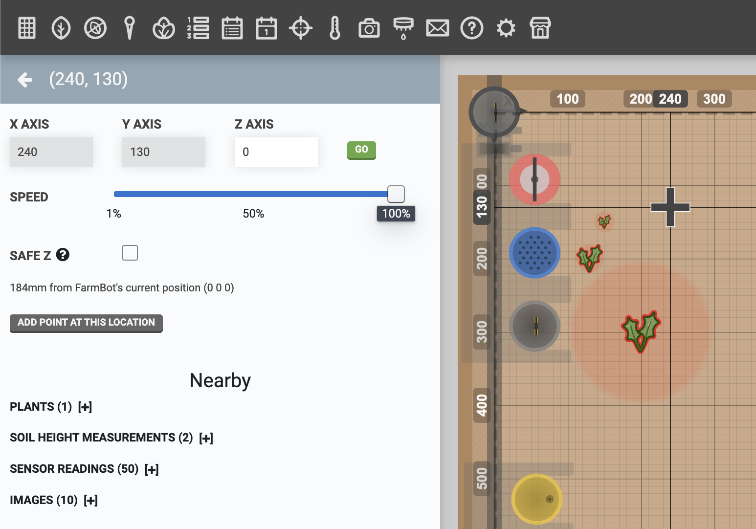
Click anywhere within the map grid to mark the location with crosshairs and open up the location panel for the selected coordinates. Then press to send FarmBot to the selected position. Before moving to the new location, you may optionally enter a new coordinate for the Z AXIS, adjust the SPEED, or toggle on SAFE Z option.
Select mode
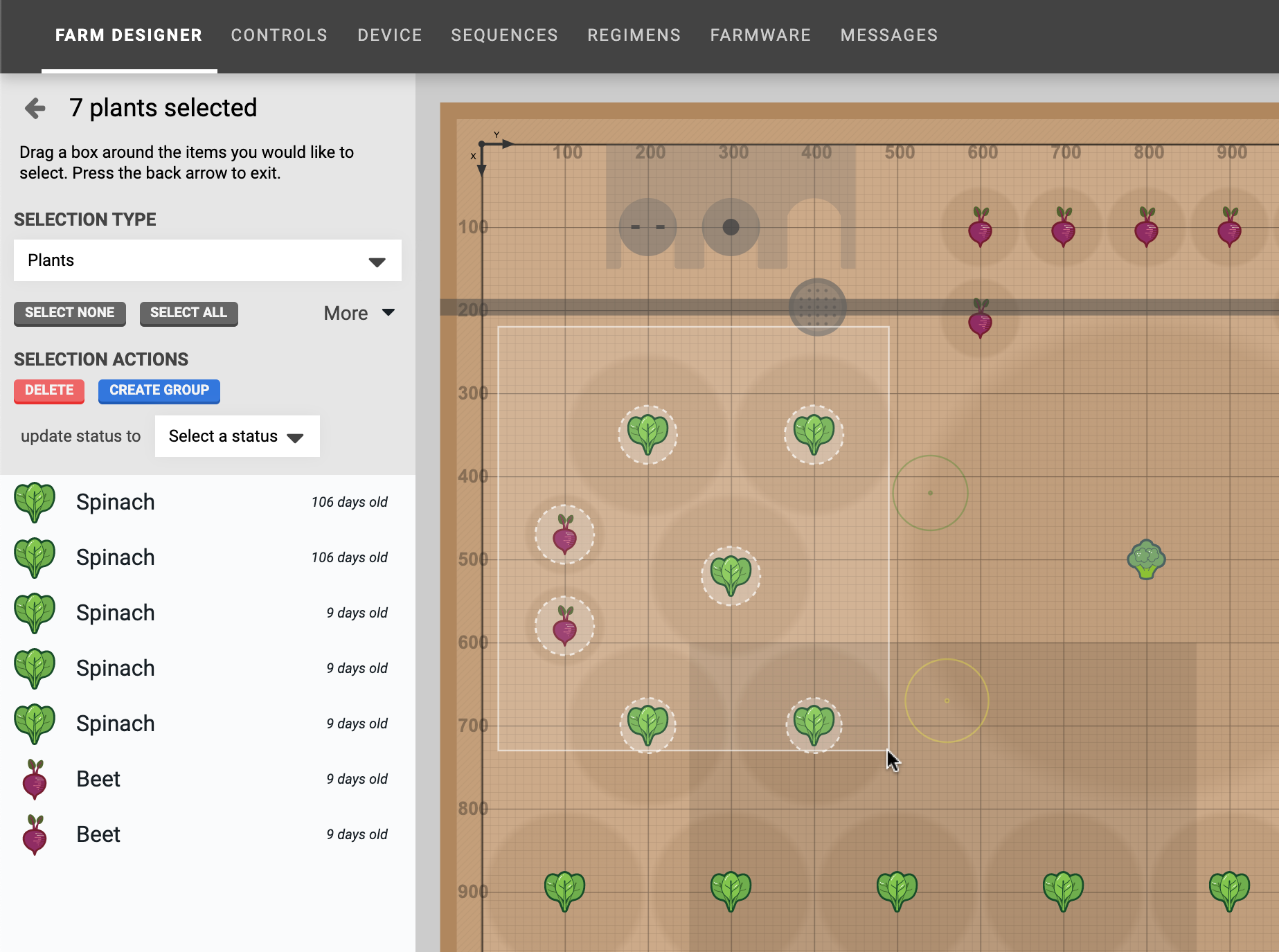
To select multiple plants, click anywhere in the map and drag the mouse cursor to create a box selection. All plants located within the box will be displayed in the select panel. Alternatively, you may press the button located in the map menu, and then use the box-selection technique.
Once the select panel is open, you can click-to-add additional plants to the selection, or click an already selected plant to remove it from the selection. Once you are satisfied with your selection, use one of the SELECTION ACTIONS.
You may also change the SELECTION TYPE to allow for selecting other objects in the map, such as weeds or points.
Profile viewer
Press the icon at the bottom of the screen to open the profile viewer.
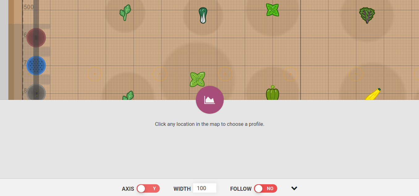
Click anywhere in the farm designer map to view a profile of that location. A shaded area will appear across the map to indicate the region the profile represents: any items within the region will appear in the profile.
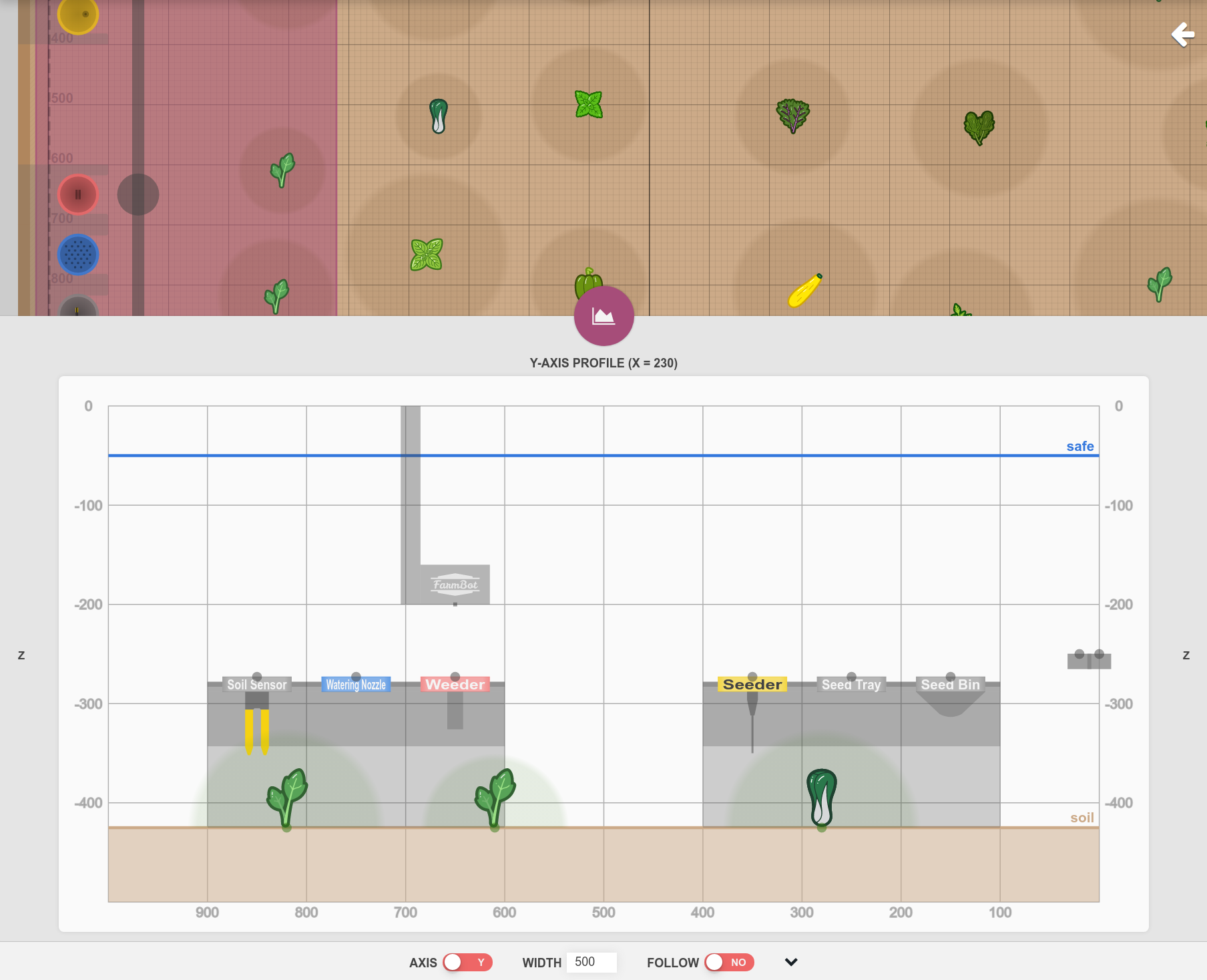
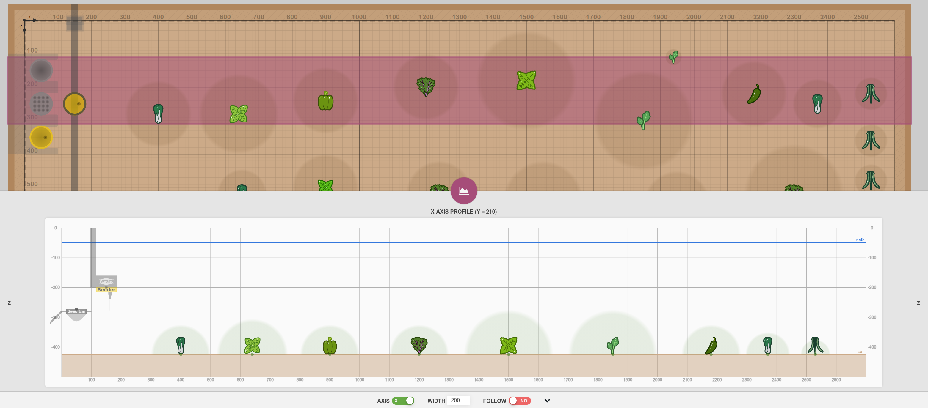
The selected SAFE HEIGHT (from axis settings) is shown as a horizontal blue line, and the selected SOIL HEIGHT is shown as a horizontal brown line. Points and soil height points are shown as dots with lines connecting them according to their color.
Use the AXIS toggle to switch between X and Y axis profiles. Input a different WIDTH to narrow or broaden the profile search area. Enable FOLLOW to use FarmBot’s current location as the profile position. Click the icon to switch between quick and full profile views.
What’s next?
- Plants
Add and manage the plants in your garden
- Groups
Organize your plants, weeds, and points
- Events
Schedule FarmBot actions


- Points
Create custom locations in your garden

- Weeds
Manage the weeds found in your garden
- Controls
Manually control your FarmBot from anywhere!

- Sensors
Manually read FarmBot’s sensors 🌡️
- Photos
Take and view photos of your plants

- Tools
Manage tools and seed containers

- Settings
Manage app and FarmBot settings